The United Democratic Republic Kingdom of the Federation of America
Political Mapping of the Federation
Continent Implanaria
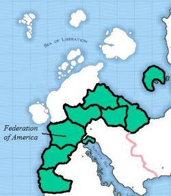
Black lines represent state boarders. Pink represents other country's national boarders. White represents other countries.
There are no other maps current of this continent and the Federation's land.
Continent Nikos
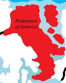
Black lines represent other country's national boarders. White represents other countries.
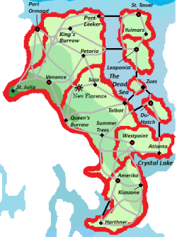
Nikos: Motherland
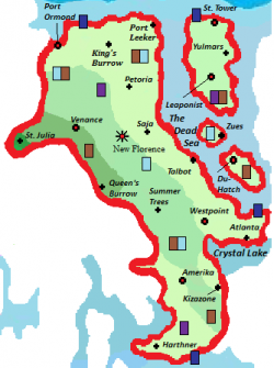
The darker the green represents the higher the land.
The Federation calls Nikos it's motherland. This map to the right shows the main routes in the Federation. The gray represents interstate and the black represents an interstate bridge. This map also shows the most populated cities in the Federation, and most visited by tourists when they visit the Federation. The red shows state boarders.
Light Green = 20 Feet below sea-level to 700 feet above sea level
Next shade up: 701 feet to 1,300 feet above sea level
Next shade up: 1,301 feet to 1,700 feet above sea level
Darkest shade: 1700 feet to 2600 feet above sea level
Light Green = 20 Feet below sea-level to 700 feet above sea level
Next shade up: 701 feet to 1,300 feet above sea level
Next shade up: 1,301 feet to 1,700 feet above sea level
Darkest shade: 1700 feet to 2600 feet above sea level
Nikos
This map shows main military bases.
Light Blue: Air Force Base
Dark Blue: Navy Base
Brown: Army/Marine Base
Purple: Training Base
*If they are together, that means it is a mixture of the two bases.
Light Blue: Air Force Base
Dark Blue: Navy Base
Brown: Army/Marine Base
Purple: Training Base
*If they are together, that means it is a mixture of the two bases.
